
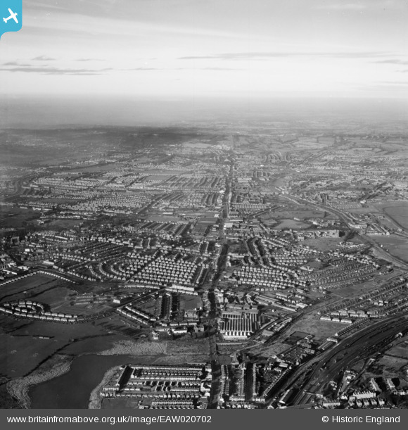
EAW020702 ENGLAND (1948). The Edgware Road running through Edgware and Stanmore, Hendon, from the south-east, 1948
© Copyright OpenStreetMap contributors and licensed by the OpenStreetMap Foundation. 2026. Cartography is licensed as CC BY-SA.
Nearby Images (14)
EAW020702

EAW043283

EAW043289

EAW043287

EAW043288

EAW043286

EPW021259

EAW043282

EAW043284

EAW043285

EAW020703

EAW020701

EPW025737

EAW020700

Details
| Title | [EAW020702] The Edgware Road running through Edgware and Stanmore, Hendon, from the south-east, 1948 |
| Reference | EAW020702 |
| Date | 17-December-1948 |
| Link | |
| Place name | HENDON |
| Parish | |
| District | |
| Country | ENGLAND |
| Easting / Northing | 521602, 188482 |
| Longitude / Latitude | -0.24476521778453, 51.58158787414 |
| National Grid Reference | TQ216885 |
Pins

Len |
Tuesday 7th of June 2022 10:33:42 PM | |
|
Len |
Tuesday 7th of June 2022 10:31:30 PM | |
|
Len |
Tuesday 7th of June 2022 10:30:21 PM | |
|
Len |
Tuesday 7th of June 2022 10:29:35 PM | |
|
Leslie B |
Monday 16th of January 2017 02:05:25 PM | |
|
Leslie B |
Monday 16th of January 2017 02:03:19 PM | |
|
ken |
Monday 15th of June 2015 08:05:36 PM | |
|
ken |
Monday 15th of June 2015 08:04:43 PM | |
|
ken |
Monday 15th of June 2015 08:03:54 PM |