
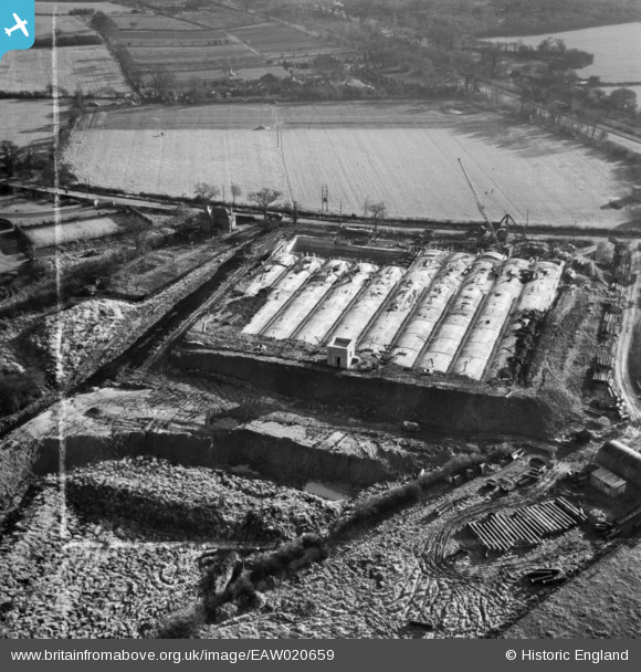
EAW020659 ENGLAND (1948). Coventry Corporation Reservoir Number 2 under construction, Meriden, 1948. This image was marked by Aerofilms Ltd for photo editing.
© Copyright OpenStreetMap contributors and licensed by the OpenStreetMap Foundation. 2026. Cartography is licensed as CC BY-SA.
Nearby Images (42)
EAW020659

EAW013558
 under construction off Showell Lane, Meriden, 1948. This image has been produced from a print.")
EAW017187

EAW013560

EAW013555
 under construction off Showell Lane, Meriden, 1948. This image has been produced from a print.")
EAW017194

EAW017199

EAW020653

EAW013557
 under construction off Showell Lane, Meriden, 1948. This image has been produced from a print.")
EAW017195

EAW017197

EAW017198

EAW013556
 under construction off Showell Lane, Meriden, 1948. This image has been produced from a print.")
EAW020654

EAW020658

EAW017200

EAW017188

EAW020652

EAW017196

EAW017191

EAW013552

EAW020656

EAW017189

EAW013550

EAW017193

EAW013551

EAW020661

EAW013553
 off Showell Lane, Meriden, 1948. This image has been produced from a print.")
EAW017190

EAW020663

EAW020664

EAW020655

EAW017192

EAW020657

EAW020660

EAW013559
 under construction off Showell Lane, Meriden, 1948. This image has been produced from a print.")
EPW035796

EPW035794

EPW035792

EPW035795

EPW035793

EAW020662

Details
| Title | [EAW020659] Coventry Corporation Reservoir Number 2 under construction, Meriden, 1948. This image was marked by Aerofilms Ltd for photo editing. |
| Reference | EAW020659 |
| Date | 15-December-1948 |
| Link | |
| Place name | MERIDEN |
| Parish | MERIDEN |
| District | |
| Country | ENGLAND |
| Easting / Northing | 425867, 282147 |
| Longitude / Latitude | -1.6194599927719, 52.436309623631 |
| National Grid Reference | SP259821 |
Pins
Be the first to add a comment to this image!