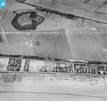
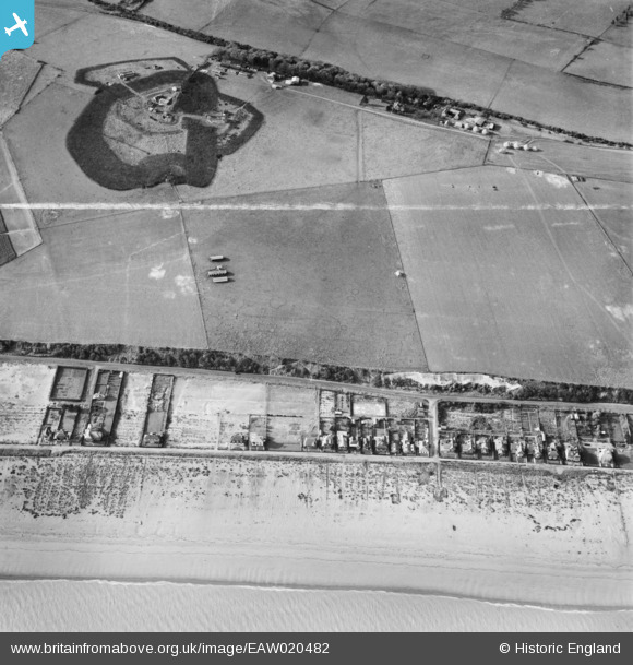
EAW020482 ENGLAND (1948). Military features on Hawkshill Down above beach housing on Wellington Road, Walmer, 1948. This image was marked by Aerofilms Ltd for photo editing.
© Copyright OpenStreetMap contributors and licensed by the OpenStreetMap Foundation. 2026. Cartography is licensed as CC BY-SA.
Nearby Images (3)
EAW020482

EAW020483

EPW000151

Details
| Title | [EAW020482] Military features on Hawkshill Down above beach housing on Wellington Road, Walmer, 1948. This image was marked by Aerofilms Ltd for photo editing. |
| Reference | EAW020482 |
| Date | 9-November-1948 |
| Link | |
| Place name | WALMER |
| Parish | WALMER |
| District | |
| Country | ENGLAND |
| Easting / Northing | 637719, 149324 |
| Longitude / Latitude | 1.402671291154, 51.193086003825 |
| National Grid Reference | TR377493 |
Pins

cptpies |
Thursday 9th of January 2014 10:52:48 AM |