
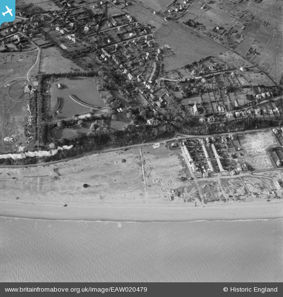
EAW020479 ENGLAND (1948). Kingsdown Holiday Camp and the beach, Kingsdown, 1948
© Copyright OpenStreetMap contributors and licensed by the OpenStreetMap Foundation. 2026. Cartography is licensed as CC BY-SA.
Details
| Title | [EAW020479] Kingsdown Holiday Camp and the beach, Kingsdown, 1948 |
| Reference | EAW020479 |
| Date | 9-November-1948 |
| Link | |
| Place name | KINGSDOWN |
| Parish | RINGWOULD WITH KINGSDOWN |
| District | |
| Country | ENGLAND |
| Easting / Northing | 637925, 148366 |
| Longitude / Latitude | 1.4049798189037, 51.184400230188 |
| National Grid Reference | TR379484 |
Pins

Jez H |
Monday 20th of June 2022 07:54:56 PM | |

Matt Aldred edob.mattaldred.com |
Monday 30th of November 2020 09:10:27 PM | |
|
Matt Aldred edob.mattaldred.com |
Monday 30th of November 2020 09:03:04 PM | |
|
Matt Aldred edob.mattaldred.com |
Monday 30th of November 2020 09:02:24 PM | |
|
Matt Aldred edob.mattaldred.com |
Monday 30th of November 2020 09:02:11 PM | |
|
Chris Kolonko |
Saturday 16th of September 2017 08:11:00 PM | |
|
Chris Kolonko |
Saturday 16th of September 2017 08:09:37 PM | |
|
Al |
Thursday 9th of January 2014 04:30:03 PM | |
|
cptpies |
Thursday 9th of January 2014 10:43:36 AM | |
|
cptpies |
Thursday 9th of January 2014 10:43:08 AM |
User Comment Contributions

WWII Emergency Battery and Beach Scaffolding. Kingsdown. |
cptpies |
Thursday 9th of January 2014 10:44:21 AM |