
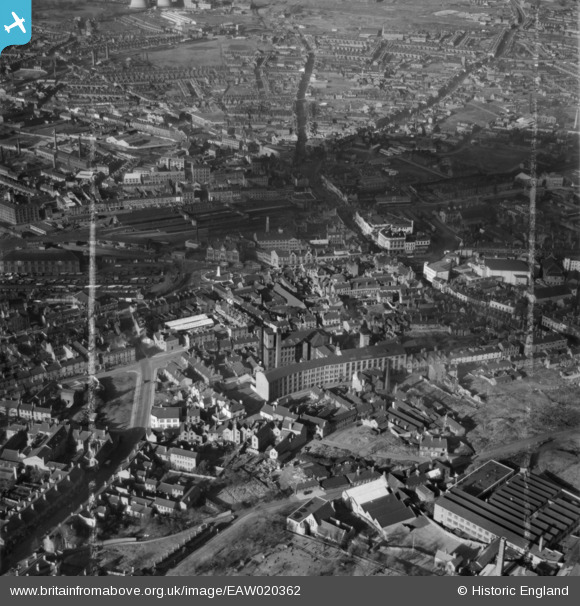
EAW020362 ENGLAND (1948). The town centre, Walsall, 1948. This image was marked by Aerofilms Ltd for photo editing.
© Copyright OpenStreetMap contributors and licensed by the OpenStreetMap Foundation. 2026. Cartography is licensed as CC BY-SA.
Nearby Images (20)
EAW020362

EAW020365

EAW020364

EPW024715

EAW020360

EAW020366

EAW020361

EPW024714

EAW020367

EAW020359

EPW005779

EAW020368

EPW015024

EPW005672

EPW005775

EPW015021

EAW020363

EPW005671

EPW015022

EPW047229

Details
| Title | [EAW020362] The town centre, Walsall, 1948. This image was marked by Aerofilms Ltd for photo editing. |
| Reference | EAW020362 |
| Date | 4-November-1948 |
| Link | |
| Place name | WALSALL |
| Parish | |
| District | |
| Country | ENGLAND |
| Easting / Northing | 401270, 298373 |
| Longitude / Latitude | -1.9812543189237, 52.582807707138 |
| National Grid Reference | SP013984 |
Pins
Be the first to add a comment to this image!