
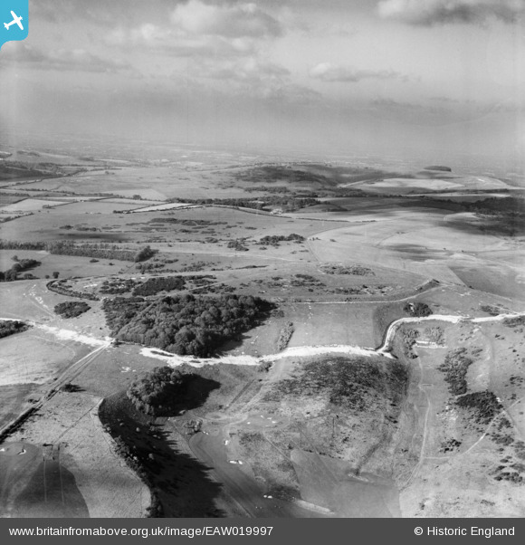
EAW019997 ENGLAND (1948). Cissbury Ring and Vineyard Hill, Cissbury Ring, from the south-east, 1948
© Copyright OpenStreetMap contributors and licensed by the OpenStreetMap Foundation. 2026. Cartography is licensed as CC BY-SA.
Details
| Title | [EAW019997] Cissbury Ring and Vineyard Hill, Cissbury Ring, from the south-east, 1948 |
| Reference | EAW019997 |
| Date | 19-October-1948 |
| Link | |
| Place name | CISSBURY RING |
| Parish | |
| District | |
| Country | ENGLAND |
| Easting / Northing | 514013, 107512 |
| Longitude / Latitude | -0.38001321638099, 50.855312221935 |
| National Grid Reference | TQ140075 |
Pins
User Comment Contributions

NIce view of the Cissbury Ring Anti Tank Ditch. |

cptpies |
Monday 30th of March 2015 02:10:36 PM |