
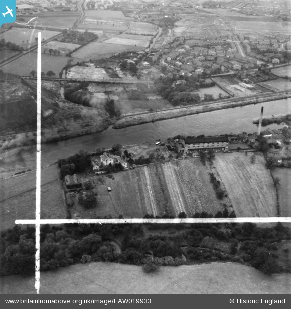
EAW019933 ENGLAND (1948). Millbank Paper Mills and environs, Partington, 1948. This image has been produced from a print marked by Aerofilms Ltd for photo editing.
© Copyright OpenStreetMap contributors and licensed by the OpenStreetMap Foundation. 2026. Cartography is licensed as CC BY-SA.
Nearby Images (18)
EAW019933

EAW019932

EAW019935

EAW020010

EAW019936

EAW020011

EAW019934

EAW050209

EAW019931

EAW050207

EAW050204

EAW050206

EAW019929

EAW019930

EAW050205

EAW050211

EAW050210

EAW050208

Details
| Title | [EAW019933] Millbank Paper Mills and environs, Partington, 1948. This image has been produced from a print marked by Aerofilms Ltd for photo editing. |
| Reference | EAW019933 |
| Date | 18-October-1948 |
| Link | |
| Place name | PARTINGTON |
| Parish | PARTINGTON |
| District | |
| Country | ENGLAND |
| Easting / Northing | 370287, 391079 |
| Longitude / Latitude | -2.447095389544, 53.415419561465 |
| National Grid Reference | SJ703911 |
Pins

Bottom Yard |
Sunday 30th of December 2018 06:34:36 PM | |
|
Bottom Yard |
Sunday 30th of December 2018 06:33:15 PM |