
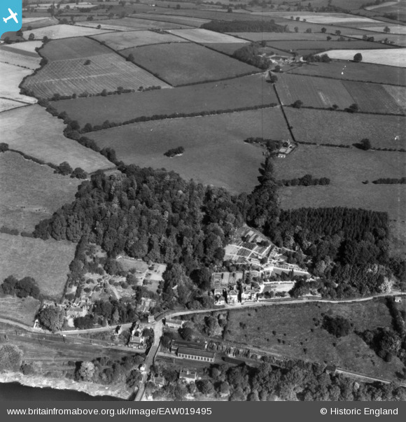
EAW019495 ENGLAND (1948). The Cottage, Coalport Station East (Goods) and the surrounding countryside, Coalport, from the south, 1948. This image has been produced from a print.
© Copyright OpenStreetMap contributors and licensed by the OpenStreetMap Foundation. 2026. Cartography is licensed as CC BY-SA.
Nearby Images (5)
EAW019495
 and the surrounding countryside, Coalport, from the south, 1948. This image has been produced from a print.")
EAW019496

EAW019494

EAW019492

EAW019493

Details
| Title | [EAW019495] The Cottage, Coalport Station East (Goods) and the surrounding countryside, Coalport, from the south, 1948. This image has been produced from a print. |
| Reference | EAW019495 |
| Date | 5-October-1948 |
| Link | |
| Place name | COALPORT |
| Parish | THE GORGE |
| District | |
| Country | ENGLAND |
| Easting / Northing | 370271, 302181 |
| Longitude / Latitude | -2.4391465390874, 52.616232334923 |
| National Grid Reference | SJ703022 |
Pins

Matt Aldred edob.mattaldred.com |
Wednesday 1st of March 2023 05:11:04 PM | |

Mickeygo |
Thursday 9th of January 2020 12:07:18 PM | |
|
Mickeygo |
Thursday 9th of January 2020 12:06:00 PM |