
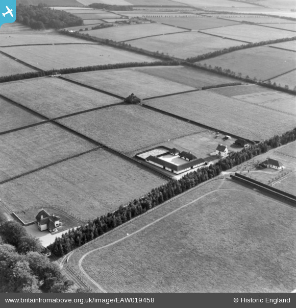
EAW019458 ENGLAND (1948). Dunchurch Lodge Stud (Rockingham Yard), Saxon Street, 1948. This image has been produced from a print.
© Copyright OpenStreetMap contributors and licensed by the OpenStreetMap Foundation. 2026. Cartography is licensed as CC BY-SA.
Nearby Images (5)
EAW019458
, Saxon Street, 1948. This image has been produced from a print.")
EAW019457
, Saxon Street, 1948. This image has been produced from a print marked by Aerofilms Ltd for photo editing.")
EAW019456
, Saxon Street, 1948. This image has been produced from a print marked by Aerofilms Ltd for photo editing.")
EAW019454

EAW019453

Details
| Title | [EAW019458] Dunchurch Lodge Stud (Rockingham Yard), Saxon Street, 1948. This image has been produced from a print. |
| Reference | EAW019458 |
| Date | 30-September-1948 |
| Link | |
| Place name | SAXON STREET |
| Parish | WOODDITTON |
| District | |
| Country | ENGLAND |
| Easting / Northing | 565869, 261905 |
| Longitude / Latitude | 0.42901200852191, 52.229925721223 |
| National Grid Reference | TL659619 |
Pins
Be the first to add a comment to this image!