
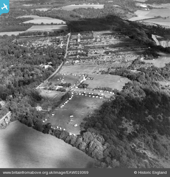
EAW019369 ENGLAND (1948). The Caravan Park off Boxhill Road and environs, Box Hill, 1948. This image has been produced from a print.
© Copyright OpenStreetMap contributors and licensed by the OpenStreetMap Foundation. 2026. Cartography is licensed as CC BY-SA.
Nearby Images (7)
EAW019369

EAW002297

EAW002296

EAW019381

EAW019368

EAW019380

EAW019379

Details
| Title | [EAW019369] The Caravan Park off Boxhill Road and environs, Box Hill, 1948. This image has been produced from a print. |
| Reference | EAW019369 |
| Date | 30-September-1948 |
| Link | |
| Place name | BOX HILL |
| Parish | |
| District | |
| Country | ENGLAND |
| Easting / Northing | 519769, 151507 |
| Longitude / Latitude | -0.28370499706614, 51.249628129783 |
| National Grid Reference | TQ198515 |
Pins
Be the first to add a comment to this image!