
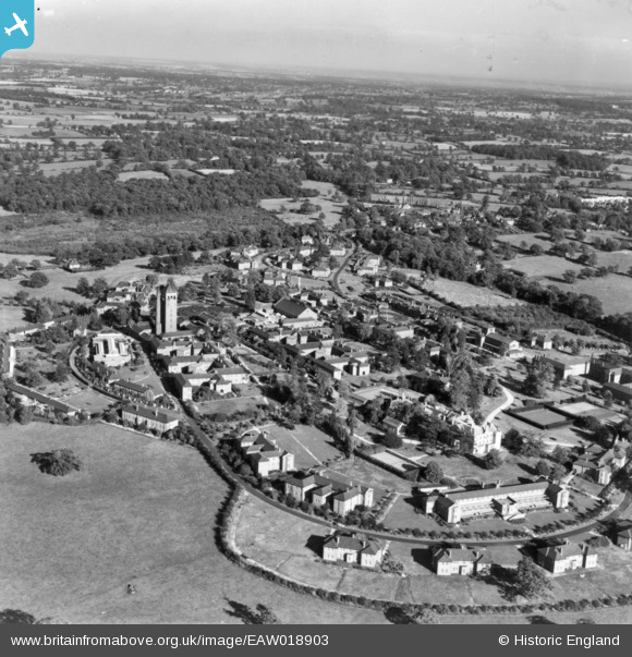
EAW018903 ENGLAND (1948). Shenley Hospital, Shenley, from the west, 1948. This image has been produced from a print.
© Copyright OpenStreetMap contributors and licensed by the OpenStreetMap Foundation. 2026. Cartography is licensed as CC BY-SA.
Nearby Images (14)
EAW018903

EAW018906

EAW018902

EAW018901

EPW015745

EPW049672

EPW043679

EAW018900

EAW018910

EPW044112

EAW019111

EPW043666

EPW043669

EAW019113

Details
| Title | [EAW018903] Shenley Hospital, Shenley, from the west, 1948. This image has been produced from a print. |
| Reference | EAW018903 |
| Date | 28-September-1948 |
| Link | |
| Place name | SHENLEY |
| Parish | SHENLEY |
| District | |
| Country | ENGLAND |
| Easting / Northing | 517905, 200825 |
| Longitude / Latitude | -0.29394394893259, 51.693316352157 |
| National Grid Reference | TL179008 |
Pins

Matt Aldred edob.mattaldred.com |
Friday 8th of March 2024 12:04:11 PM | |
|
Matt Aldred edob.mattaldred.com |
Friday 8th of March 2024 12:00:48 PM | |
|
Matt Aldred edob.mattaldred.com |
Friday 8th of March 2024 12:00:37 PM |