
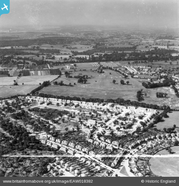
EAW018382 ENGLAND (1948). Construction of the Coppice Estate, Bromley, from the north-east, 1948. This image has been produced from a print marked by Aerofilms Ltd for photo editing.
© Copyright OpenStreetMap contributors and licensed by the OpenStreetMap Foundation. 2025. Cartography is licensed as CC BY-SA.
Nearby Images (6)
EAW018382

EAW018383

EAW018387

EAW018385

EAW018386

EAW018384

Details
| Title | [EAW018382] Construction of the Coppice Estate, Bromley, from the north-east, 1948. This image has been produced from a print marked by Aerofilms Ltd for photo editing. |
| Reference | EAW018382 |
| Date | 27-August-1948 |
| Link | |
| Place name | BROMLEY |
| Parish | |
| District | |
| Country | ENGLAND |
| Easting / Northing | 543293, 167088 |
| Longitude / Latitude | 0.059444093401961, 51.384228584147 |
| National Grid Reference | TQ433671 |
Pins

Karen |
Wednesday 14th of August 2019 09:08:22 PM |