
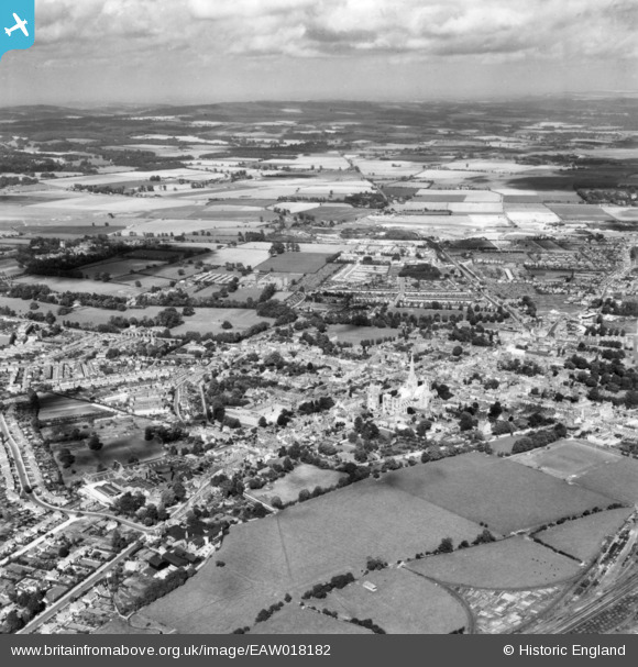
EAW018182 ENGLAND (1948). The city, Chichester, from the south-west, 1948. This image has been produced from a print.
© Copyright OpenStreetMap contributors and licensed by the OpenStreetMap Foundation. 2026. Cartography is licensed as CC BY-SA.
Nearby Images (9)
EAW018182

EPW000663

EPW000664

EAW018179

EPW022964

EPW022956

EPW000665

EAW018184

EAW018183

Details
| Title | [EAW018182] The city, Chichester, from the south-west, 1948. This image has been produced from a print. |
| Reference | EAW018182 |
| Date | 16-August-1948 |
| Link | |
| Place name | CHICHESTER |
| Parish | CHICHESTER |
| District | |
| Country | ENGLAND |
| Easting / Northing | 485656, 104714 |
| Longitude / Latitude | -0.78347326112221, 50.835050788483 |
| National Grid Reference | SU857047 |
Pins

Carl |
Monday 15th of May 2023 04:14:36 PM | |
|
Paula-in-Chi |
Wednesday 20th of April 2016 11:17:07 AM | |
|
Paula-in-Chi |
Wednesday 30th of September 2015 05:01:17 PM |