
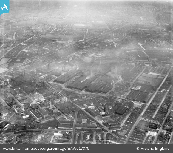
EAW017375 ENGLAND (1948). The English Steel Corporation North Street Works and environs, Openshaw, from the south-west, 1948. This image has been produced from a print.
© Copyright OpenStreetMap contributors and licensed by the OpenStreetMap Foundation. 2026. Cartography is licensed as CC BY-SA.
Nearby Images (15)
EAW017375

EAW017372

EAW036136

EAW025664

EAW022088

EAW025660

EAW017374

EAW025665

EAW025658

EAW017371

EAW017373

EAW036131

EAW025663

EAW022087

EAW022085

Details
| Title | [EAW017375] The English Steel Corporation North Street Works and environs, Openshaw, from the south-west, 1948. This image has been produced from a print. |
| Reference | EAW017375 |
| Date | 20-July-1948 |
| Link | |
| Place name | OPENSHAW |
| Parish | |
| District | |
| Country | ENGLAND |
| Easting / Northing | 387674, 397881 |
| Longitude / Latitude | -2.1857400325222, 53.477258930835 |
| National Grid Reference | SJ877979 |
Pins
Be the first to add a comment to this image!