
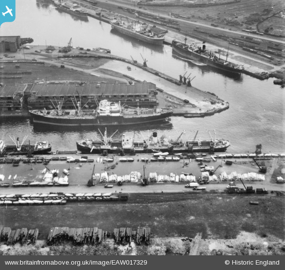
EAW017329 ENGLAND (1948). The Manchester Ship Canal and entrance to No 9 Dock, Salford, 1948. This image has been produced from a print.
© Copyright OpenStreetMap contributors and licensed by the OpenStreetMap Foundation. 2026. Cartography is licensed as CC BY-SA.
Nearby Images (15)
EAW017329

EAW050418

EPW028011

EPW028149

EPW028012

EPW028013

EPW027854

EPW017596

EPW027729

EPW045987

EAW050419

EPW028015

EAW000804

EPW027857

EPW027860

Details
| Title | [EAW017329] The Manchester Ship Canal and entrance to No 9 Dock, Salford, 1948. This image has been produced from a print. |
| Reference | EAW017329 |
| Date | 19-July-1948 |
| Link | |
| Place name | SALFORD |
| Parish | |
| District | |
| Country | ENGLAND |
| Easting / Northing | 380445, 397247 |
| Longitude / Latitude | -2.2946327951826, 53.471340723248 |
| National Grid Reference | SJ804972 |
Pins
Be the first to add a comment to this image!