
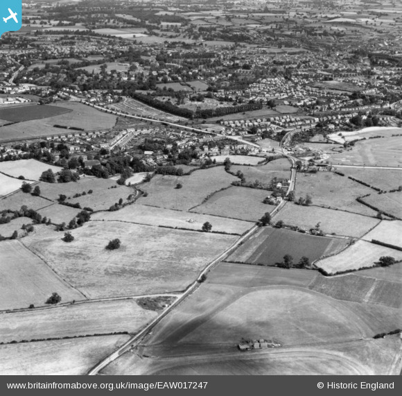
EAW017247 ENGLAND (1948). Hereford Road and environs, Meole Brace, 1948. This image has been produced from a print.
© Copyright OpenStreetMap contributors and licensed by the OpenStreetMap Foundation. 2026. Cartography is licensed as CC BY-SA.
Nearby Images (2)
EAW017247

EAW017249

Details
| Title | [EAW017247] Hereford Road and environs, Meole Brace, 1948. This image has been produced from a print. |
| Reference | EAW017247 |
| Date | 19-July-1948 |
| Link | |
| Place name | MEOLE BRACE |
| Parish | SHREWSBURY |
| District | |
| Country | ENGLAND |
| Easting / Northing | 348874, 310447 |
| Longitude / Latitude | -2.7564735064856, 52.688950222225 |
| National Grid Reference | SJ489104 |
Pins

Dan |
Wednesday 3rd of December 2014 03:30:03 PM |