
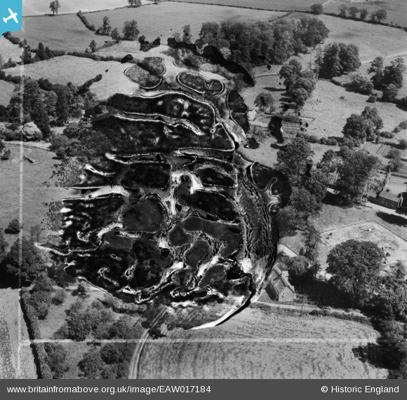
EAW017184 ENGLAND (1948). Wardington House (site of) and environs, Wardington, 1948. This image has been produced from a damaged negative.
© Copyright OpenStreetMap contributors and licensed by the OpenStreetMap Foundation. 2026. Cartography is licensed as CC BY-SA.
Nearby Images (5)
EAW017184
 and environs, Wardington, 1948. This image has been produced from a damaged negative.")
EAW017185

EAW017186

EAW017182

EAW017183

Details
| Title | [EAW017184] Wardington House (site of) and environs, Wardington, 1948. This image has been produced from a damaged negative. |
| Reference | EAW017184 |
| Date | 19-July-1948 |
| Link | |
| Place name | WARDINGTON |
| Parish | WARDINGTON |
| District | |
| Country | ENGLAND |
| Easting / Northing | 449003, 246665 |
| Longitude / Latitude | -1.2842763590638, 52.115719859358 |
| National Grid Reference | SP490467 |
Pins
Be the first to add a comment to this image!