
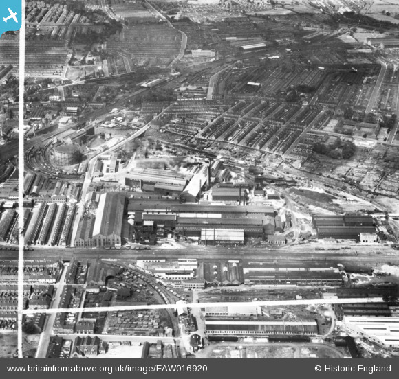
EAW016920 ENGLAND (1948). The Darlington Forge Ltd Works and the surrounding area, Darlington, 1948. This image has been produced from a print marked by Aerofilms Ltd for photo editing.
© Copyright OpenStreetMap contributors and licensed by the OpenStreetMap Foundation. 2026. Cartography is licensed as CC BY-SA.
Nearby Images (10)
EAW016920

EAW016914

EAW016911
 and environs, Darlington, 1948. This image has been produced from a damaged negative.")
EAW016915

EAW016913

EAW016917

EAW016919

EAW016916

EAW016912
 and environs, Darlington, 1948. This image has been produced from a damaged negative.")
EAW016918

Details
| Title | [EAW016920] The Darlington Forge Ltd Works and the surrounding area, Darlington, 1948. This image has been produced from a print marked by Aerofilms Ltd for photo editing. |
| Reference | EAW016920 |
| Date | 30-June-1948 |
| Link | |
| Place name | DARLINGTON |
| Parish | |
| District | |
| Country | ENGLAND |
| Easting / Northing | 429489, 515783 |
| Longitude / Latitude | -1.5442026040009, 54.53633026202 |
| National Grid Reference | NZ295158 |
