
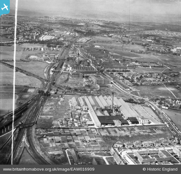
EAW016909 ENGLAND (1948). The Cooperative Wholesale Society Ltd Pelaw Works along Shields Road, Bill Quay, from the east, 1948. This image has been produced from a print marked by Aerofilms Ltd for photo editing.
© Copyright OpenStreetMap contributors and licensed by the OpenStreetMap Foundation. 2026. Cartography is licensed as CC BY-SA.
Nearby Images (12)
EAW016909

EPW060860

EPW060857

EPW060863

EPW060862

EPW060858

EPW060861

EPW060859

EPW060864

EAW016910

EAW016901
 and environs, Bill Quay, 1948. This image has been produced from a print.")
EAW016902
 and environs, Bill Quay, from the south, 1948. This image has been produced from a print marked by Aerofilms Ltd for photo editing.")
Details
| Title | [EAW016909] The Cooperative Wholesale Society Ltd Pelaw Works along Shields Road, Bill Quay, from the east, 1948. This image has been produced from a print marked by Aerofilms Ltd for photo editing. |
| Reference | EAW016909 |
| Date | 30-June-1948 |
| Link | |
| Place name | BILL QUAY |
| Parish | |
| District | |
| Country | ENGLAND |
| Easting / Northing | 429856, 562301 |
| Longitude / Latitude | -1.5337524868451, 54.954380092095 |
| National Grid Reference | NZ299623 |
Pins

ozzie1980 |
Monday 29th of April 2024 02:32:03 PM | |
|
redmist |
Sunday 2nd of October 2022 10:44:23 AM | |
|
redmist |
Sunday 2nd of October 2022 10:37:26 AM | |
|
redmist |
Sunday 2nd of October 2022 10:34:55 AM | |
|
N Dunn |
Friday 17th of November 2017 01:22:53 PM | |
 |
N Dunn |
Friday 17th of November 2017 01:21:53 PM |
|
N Dunn |
Friday 17th of November 2017 01:17:31 PM | |
|
N Dunn |
Friday 17th of November 2017 01:13:43 PM |