
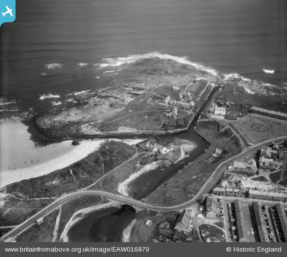
EAW016879 ENGLAND (1948). Seaton Sluice Harbour, Seaton Sluice, 1948
© Copyright OpenStreetMap contributors and licensed by the OpenStreetMap Foundation. 2026. Cartography is licensed as CC BY-SA.
Nearby Images (7)
EAW016879

EAW016878

EAW016880

EAW016881

EAW016882

EAW016877

EAW016855

Details
| Title | [EAW016879] Seaton Sluice Harbour, Seaton Sluice, 1948 |
| Reference | EAW016879 |
| Date | 24-June-1948 |
| Link | |
| Place name | SEATON SLUICE |
| Parish | SEATON VALLEY |
| District | |
| Country | ENGLAND |
| Easting / Northing | 433733, 576856 |
| Longitude / Latitude | -1.4714919920391, 55.084935892664 |
| National Grid Reference | NZ337769 |
Pins

Matt Aldred edob.mattaldred.com |
Monday 30th of November 2020 07:02:02 PM | |

cptpies |
Thursday 20th of December 2018 02:14:08 PM | |
|
cptpies |
Thursday 20th of December 2018 02:12:45 PM | |
|
jrussill |
Tuesday 2nd of December 2014 06:45:05 PM |
