
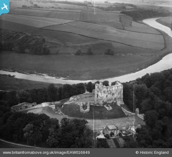
EAW016849 ENGLAND (1948). Norham Castle, Norham, 1948
© Copyright OpenStreetMap contributors and licensed by the OpenStreetMap Foundation. 2026. Cartography is licensed as CC BY-SA.
Nearby Images (10)
EAW016849

EAW006103

EAW016847

EAW016848

EAW006105

EAW006106

EAW006108

EAW016850

EAW006107

EAW006104

Details
| Title | [EAW016849] Norham Castle, Norham, 1948 |
| Reference | EAW016849 |
| Date | 24-June-1948 |
| Link | |
| Place name | NORHAM |
| Parish | NORHAM |
| District | |
| Country | ENGLAND |
| Easting / Northing | 390546, 647672 |
| Longitude / Latitude | -2.1505221459682, 55.722386865418 |
| National Grid Reference | NT905477 |
Pins
Be the first to add a comment to this image!
User Comment Contributions

Norham Castle |

Robert - Cumbria |
Saturday 1st of February 2014 10:10:12 PM |
|
Norham Castle |
Robert - Cumbria |
Saturday 1st of February 2014 10:09:30 PM |