
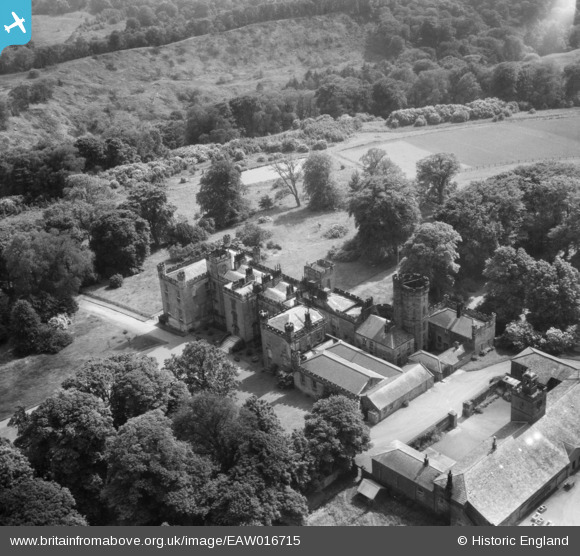
EAW016715 ENGLAND (1948). Mulgrave Castle and Stable Building, Mulgrave Castle, 1948
© Copyright OpenStreetMap contributors and licensed by the OpenStreetMap Foundation. 2026. Cartography is licensed as CC BY-SA.
Nearby Images (7)
EAW016715

EAW016714

EAW016710

EAW016712

EAW016713

EAW016711

EAW016716

Details
| Title | [EAW016715] Mulgrave Castle and Stable Building, Mulgrave Castle, 1948 |
| Reference | EAW016715 |
| Date | 23-June-1948 |
| Link | |
| Place name | MULGRAVE CASTLE |
| Parish | LYTHE |
| District | |
| Country | ENGLAND |
| Easting / Northing | 484786, 512544 |
| Longitude / Latitude | -0.69060178147692, 54.500987336193 |
| National Grid Reference | NZ848125 |
Pins
Be the first to add a comment to this image!