
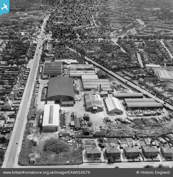
EAW016579 ENGLAND (1948). Mann Egerton Cromer Road Works, Hellesdon, 1948. This image has been produced from a damaged negative.
© Copyright OpenStreetMap contributors and licensed by the OpenStreetMap Foundation. 2026. Cartography is licensed as CC BY-SA.
Nearby Images (12)
EAW016579

EAW016573

EAW016577
, Hellesdon, 1948. This image has been produced from a damaged negative.")
EAW016574

EAW016570

EAW016571

EAW016572

EAW016576

EAW016580

EAW016578

EAW016581

EAW016575

Details
| Title | [EAW016579] Mann Egerton Cromer Road Works, Hellesdon, 1948. This image has been produced from a damaged negative. |
| Reference | EAW016579 |
| Date | 14-June-1948 |
| Link | |
| Place name | HELLESDON |
| Parish | HELLESDON |
| District | |
| Country | ENGLAND |
| Easting / Northing | 621593, 311778 |
| Longitude / Latitude | 1.2768782346274, 52.658014828832 |
| National Grid Reference | TG216118 |
Pins

Matt Aldred edob.mattaldred.com |
Wednesday 16th of March 2022 07:42:16 PM | |
|
Matt Aldred edob.mattaldred.com |
Wednesday 16th of March 2022 07:41:15 PM | |
|
Matt Aldred edob.mattaldred.com |
Wednesday 16th of March 2022 07:39:53 PM |