
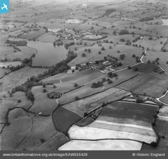
EAW016428 ENGLAND (1948). Marbury Hall and Marbury Hall Farm, Marbury, 1948. This image has been produced from a print.
© Copyright OpenStreetMap contributors and licensed by the OpenStreetMap Foundation. 2026. Cartography is licensed as CC BY-SA.
Nearby Images (7)
EAW016428

EAW016424

EAW016430

EAW016421

EAW016423

EAW016429

EAW016425

Details
| Title | [EAW016428] Marbury Hall and Marbury Hall Farm, Marbury, 1948. This image has been produced from a print. |
| Reference | EAW016428 |
| Date | 9-June-1948 |
| Link | |
| Place name | MARBURY |
| Parish | MARBURY CUM QUOISLEY |
| District | |
| Country | ENGLAND |
| Easting / Northing | 356099, 344974 |
| Longitude / Latitude | -2.6542277448298, 52.999977400288 |
| National Grid Reference | SJ561450 |
Pins
Be the first to add a comment to this image!