
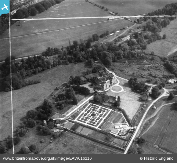
EAW016216 ENGLAND (1948). Lullingstone Castle, Eynsford, 1948. This image has been produced from a print marked by Aerofilms Ltd for photo editing.
© Copyright OpenStreetMap contributors and licensed by the OpenStreetMap Foundation. 2026. Cartography is licensed as CC BY-SA.
Nearby Images (9)
EAW016216

EAW016221

EAW016217
, Eynsford, 1948. This image has been produced from a damaged negative.")
EAW016220

EAW016218

EAW016219

EAW016222

EAW016215

EAW023112

Details
| Title | [EAW016216] Lullingstone Castle, Eynsford, 1948. This image has been produced from a print marked by Aerofilms Ltd for photo editing. |
| Reference | EAW016216 |
| Date | 8-June-1948 |
| Link | |
| Place name | EYNSFORD |
| Parish | EYNSFORD |
| District | |
| Country | ENGLAND |
| Easting / Northing | 553055, 164365 |
| Longitude / Latitude | 0.19846588934885, 51.357210729811 |
| National Grid Reference | TQ531644 |
Pins
Be the first to add a comment to this image!