
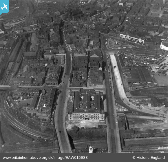
EAW015988 ENGLAND (1948). The Town Hall, Knowsley Street and Manchester Road, Bury, 1948. This image has been produced from a print.
© Copyright OpenStreetMap contributors and licensed by the OpenStreetMap Foundation. 2026. Cartography is licensed as CC BY-SA.
Nearby Images (10)
EAW015988

EPW046161

EPW042022

EAW015987

EAW015989

EPW048645

EAW015986

EPW048661

EPW046164

EPW048659

Details
| Title | [EAW015988] The Town Hall, Knowsley Street and Manchester Road, Bury, 1948. This image has been produced from a print. |
| Reference | EAW015988 |
| Date | 19-May-1948 |
| Link | |
| Place name | BURY |
| Parish | |
| District | |
| Country | ENGLAND |
| Easting / Northing | 380277, 410518 |
| Longitude / Latitude | -2.2980003101018, 53.590631371068 |
| National Grid Reference | SD803105 |
Pins

Paul Williams |
Wednesday 13th of May 2026 10:33:31 PM | |
|
Mikeya |
Tuesday 14th of October 2025 05:57:12 PM | |
|
H.J.Hill |
Friday 8th of March 2019 06:29:30 PM | |
|
H.J.Hill |
Friday 8th of March 2019 06:29:10 PM | |
|
H.J.Hill |
Friday 8th of March 2019 06:28:50 PM | |
|
Dolphin |
Saturday 8th of December 2018 08:43:18 PM | |
|
Dolphin |
Saturday 8th of December 2018 08:42:05 PM |