
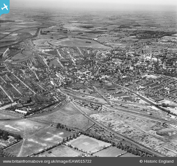
EAW015722 ENGLAND (1948). The city, Lincoln, from the south-east, 1948
© Copyright OpenStreetMap contributors and licensed by the OpenStreetMap Foundation. 2026. Cartography is licensed as CC BY-SA.
Nearby Images (5)
EAW015722

EAW015723

EAW015721

EAW015720

EPW016311

Details
| Title | [EAW015722] The city, Lincoln, from the south-east, 1948 |
| Reference | EAW015722 |
| Date | 18-May-1948 |
| Link | |
| Place name | LINCOLN |
| Parish | |
| District | |
| Country | ENGLAND |
| Easting / Northing | 498270, 370708 |
| Longitude / Latitude | -0.52787768040357, 53.224035303502 |
| National Grid Reference | SK983707 |
Pins

redmist |
Thursday 10th of March 2022 06:40:37 PM | |
|
Ian |
Sunday 18th of March 2018 10:30:23 AM | |
|
Ian |
Sunday 18th of March 2018 10:27:19 AM | |
|
Ian |
Sunday 18th of March 2018 10:24:01 AM | |
|
Lincsrailman |
Friday 12th of December 2014 09:33:01 PM | |
|
Lincsrailman |
Friday 12th of December 2014 09:31:57 PM |