
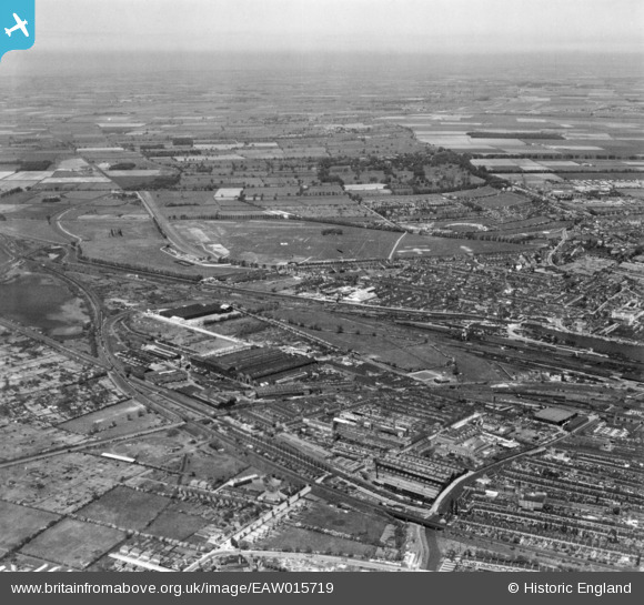
EAW015719 ENGLAND (1948). New Boultham, Lincoln, from the south-east, 1948. This image has been produced from a print.
© Copyright OpenStreetMap contributors and licensed by the OpenStreetMap Foundation. 2026. Cartography is licensed as CC BY-SA.
Nearby Images (25)
EAW015719

EPW059428

EPW016181

EPW016313

EAW007114

EPW016178

EAW007117

EAW007121

EAW007125

EAW007119

EAW007118

EAW007123

EPW016310

EAW007122

EAW007124

EPW016179

EAW007126

EAW015716

EAW007116

EPW016180

EPW016312

EPW059426

EPW059431

EPW059427

EAW007115

Details
| Title | [EAW015719] New Boultham, Lincoln, from the south-east, 1948. This image has been produced from a print. |
| Reference | EAW015719 |
| Date | 18-May-1948 |
| Link | |
| Place name | LINCOLN |
| Parish | |
| District | |
| Country | ENGLAND |
| Easting / Northing | 496686, 370687 |
| Longitude / Latitude | -0.55160460792972, 53.22413724238 |
| National Grid Reference | SK967707 |
Pins

redmist |
Thursday 10th of March 2022 06:58:31 PM | |
|
Bristol MW |
Wednesday 23rd of October 2019 06:07:23 AM | |
|
gBr |
Wednesday 19th of April 2017 04:04:02 PM |