
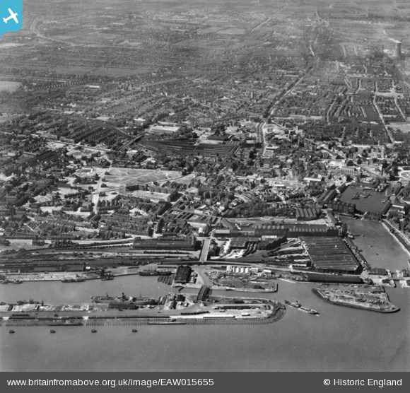
EAW015655 ENGLAND (1948). The city around Albert Dock Basin and Paragon Railway Station, Kingston upon Hull, from the south, 1948. This image has been produced from a print.
© Copyright OpenStreetMap contributors and licensed by the OpenStreetMap Foundation. 2026. Cartography is licensed as CC BY-SA.
Nearby Images (2)
EAW015655

EPW012809

Details
| Title | [EAW015655] The city around Albert Dock Basin and Paragon Railway Station, Kingston upon Hull, from the south, 1948. This image has been produced from a print. |
| Reference | EAW015655 |
| Date | 18-May-1948 |
| Link | |
| Place name | KINGSTON UPON HULL |
| Parish | |
| District | |
| Country | ENGLAND |
| Easting / Northing | 509441, 428023 |
| Longitude / Latitude | -0.34062375596803, 53.736870562895 |
| National Grid Reference | TA094280 |
Pins

redmist |
Friday 15th of October 2021 07:52:29 PM | |
|
redmist |
Friday 15th of October 2021 07:52:08 PM | |
|
redmist |
Friday 15th of October 2021 07:51:30 PM | |
|
redmist |
Friday 15th of October 2021 07:48:37 PM | |
|
Chris Kolonko |
Wednesday 17th of July 2019 08:04:33 AM | |
|
John Wass |
Wednesday 17th of June 2015 03:06:12 PM |