
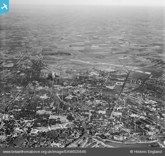
EAW015646 ENGLAND (1948). The city, Kingston upon Hull, from the south, 1948
© Copyright OpenStreetMap contributors and licensed by the OpenStreetMap Foundation. 2026. Cartography is licensed as CC BY-SA.
Nearby Images (20)
EAW015646

EPW055046

EPW009401

EAW036964

EPW036505

EAW036970

EAW046137

EAW036962

EPW009378

EAW036966

EAW036971

EAW036963

EAW036861

EAW036973

EAW036972

EAW036969

EPW012700

EAW036965

EAW036968

EAW036967

Details
| Title | [EAW015646] The city, Kingston upon Hull, from the south, 1948 |
| Reference | EAW015646 |
| Date | 18-May-1948 |
| Link | |
| Place name | KINGSTON UPON HULL |
| Parish | |
| District | |
| Country | ENGLAND |
| Easting / Northing | 510280, 429188 |
| Longitude / Latitude | -0.32749282942164, 53.747161630229 |
| National Grid Reference | TA103292 |
Pins
 |

ladyceecee |
Thursday 16th of November 2023 05:58:54 PM |
|
redmist |
Tuesday 19th of October 2021 09:43:23 PM | |
|
redmist |
Tuesday 19th of October 2021 09:33:35 PM | |
|
redmist |
Tuesday 19th of October 2021 09:06:12 PM | |
|
redmist |
Tuesday 19th of October 2021 09:01:56 PM | |
|
redmist |
Tuesday 19th of October 2021 08:58:47 PM | |
|
redmist |
Tuesday 19th of October 2021 08:57:20 PM | |
|
redmist |
Tuesday 19th of October 2021 08:56:13 PM | |
|
redmist |
Tuesday 19th of October 2021 08:53:37 PM | |
|
redmist |
Tuesday 19th of October 2021 08:52:24 PM | |
|
redmist |
Tuesday 19th of October 2021 08:50:19 PM | |
|
redmist |
Tuesday 19th of October 2021 08:49:33 PM | |
|
redmist |
Tuesday 19th of October 2021 08:48:31 PM | |
|
redmist |
Tuesday 19th of October 2021 08:47:28 PM | |
|
redmist |
Tuesday 19th of October 2021 08:42:40 PM | |
|
redmist |
Tuesday 19th of October 2021 08:40:46 PM | |
|
redmist |
Tuesday 19th of October 2021 08:36:06 PM | |
|
luke |
Thursday 21st of January 2021 10:58:44 PM | |
|
redmist |
Thursday 1st of November 2018 04:34:49 PM | |
|
redmist |
Thursday 1st of November 2018 04:29:43 PM | |
|
redmist |
Thursday 1st of November 2018 04:27:06 PM | |
|
redmist |
Thursday 1st of November 2018 04:25:49 PM | |
|
AndyB |
Wednesday 4th of January 2017 12:52:53 PM | |
|
CartoonHead |
Tuesday 29th of December 2015 05:17:15 PM | |
|
John Wass |
Saturday 14th of February 2015 02:29:48 PM | |
|
CartoonHead |
Sunday 30th of November 2014 02:58:11 PM | |
|
CartoonHead |
Sunday 30th of November 2014 02:55:34 PM | |
|
CartoonHead |
Sunday 30th of November 2014 02:54:03 PM | |
|
CartoonHead |
Sunday 30th of November 2014 02:44:13 PM | |
|
CartoonHead |
Sunday 30th of November 2014 02:40:08 PM | |
|
CartoonHead |
Sunday 30th of November 2014 02:38:05 PM | |
In this 1948 view it is the "National" cinema. It is a replacement for the original one which was bombed during WW2 and it's shell still survives. One day it maybe properly preserved as a memorial to those killed during that time. This link tells the story. http://www.arthurlloyd.co.uk/Hull/NationalPictureTheatreHull.htm |
John Wass |
Saturday 22nd of August 2015 10:59:02 AM |
|
John Wass |
Tuesday 11th of November 2014 10:01:06 PM | |
|
HullPaul |
Wednesday 6th of August 2014 07:33:56 PM | |
|
Andy Donkin |
Sunday 15th of June 2014 11:09:00 PM | |
|
Andy Donkin |
Sunday 15th of June 2014 11:07:22 PM |
