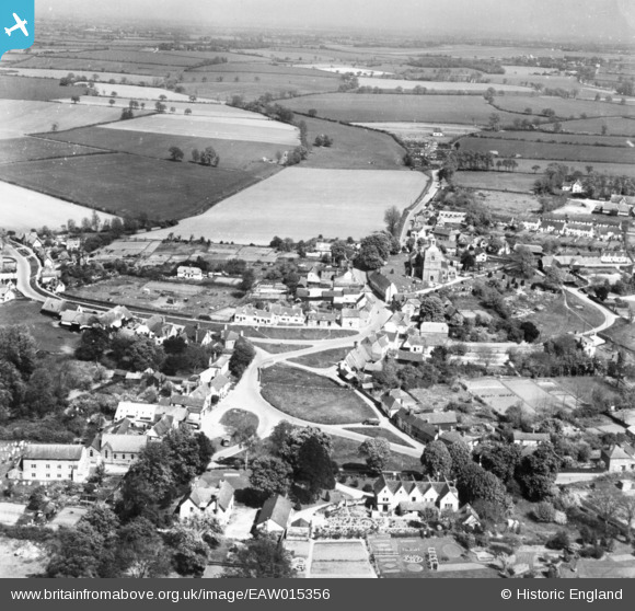
EAW015356 ENGLAND (1948). The village, Finchingfield, from the west, 1948. This image has been produced from a print.
© Copyright OpenStreetMap contributors and licensed by the OpenStreetMap Foundation. 2026. Cartography is licensed as CC BY-SA.
Nearby Images (2)
EAW015356

EAW015357

Details
| Title | [EAW015356] The village, Finchingfield, from the west, 1948. This image has been produced from a print. |
| Reference | EAW015356 |
| Date | 7-May-1948 |
| Link | |
| Place name | FINCHINGFIELD |
| Parish | FINCHINGFIELD |
| District | |
| Country | ENGLAND |
| Easting / Northing | 568424, 232796 |
| Longitude / Latitude | 0.45200153258301, 51.967655259837 |
| National Grid Reference | TL684328 |