
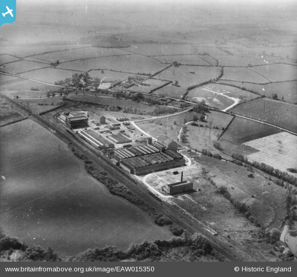
EAW015350 ENGLAND (1948). Cedars Malt Products Factory (Munton & Fison Ltd), Stowmarket, from the north, 1948. This image has been produced from a damaged print.
© Copyright OpenStreetMap contributors and licensed by the OpenStreetMap Foundation. 2026. Cartography is licensed as CC BY-SA.
Nearby Images (8)
EAW015350
, Stowmarket, from the north, 1948. This image has been produced from a damaged print.")
EAW015355
, Stowmarket, from the north-east, 1948. This image has been produced from a print marked by Aerofilms Ltd for photo editing.")
EPW024995

EAW015351
, Stowmarket, 1948. This image has been produced from a print.")
EAW015348
, Stowmarket, 1948. This image has been produced from a print.")
EAW015352
, Stowmarket, 1948. This image has been produced from a print.")
EAW015353
, Stowmarket, 1948. This image has been produced from a print marked by Aerofilms Ltd for photo editing.")
EAW015354
, Stowmarket, 1948. This image has been produced from a print marked by Aerofilms Ltd for photo editing.")
Details
| Title | [EAW015350] Cedars Malt Products Factory (Munton & Fison Ltd), Stowmarket, from the north, 1948. This image has been produced from a damaged print. |
| Reference | EAW015350 |
| Date | 7-May-1948 |
| Link | |
| Place name | STOWMARKET |
| Parish | STOWMARKET |
| District | |
| Country | ENGLAND |
| Easting / Northing | 606403, 257509 |
| Longitude / Latitude | 1.0191135483325, 52.176756739929 |
| National Grid Reference | TM064575 |
Pins

John W |
Saturday 21st of January 2017 03:57:41 PM |