
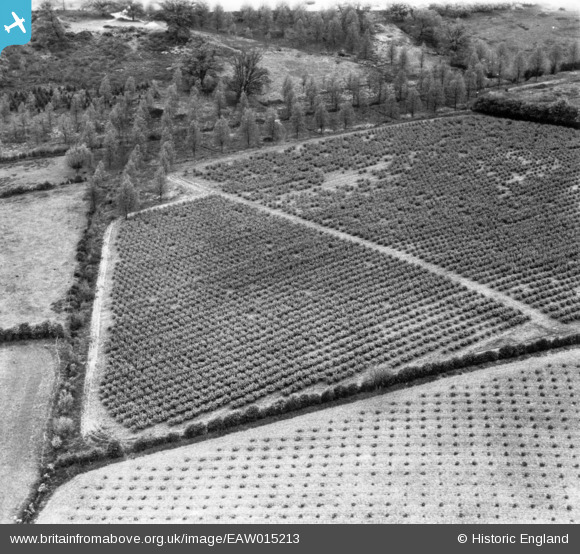
EAW015213 ENGLAND (1948). Fruit farming south of Furze Lodge, Langham, 1948. This image has been produced from a print.
© Copyright OpenStreetMap contributors and licensed by the OpenStreetMap Foundation. 2025. Cartography is licensed as CC BY-SA.
Nearby Images (3)
EAW015213

EAW015208

EAW015206

Details
| Title | [EAW015213] Fruit farming south of Furze Lodge, Langham, 1948. This image has been produced from a print. |
| Reference | EAW015213 |
| Date | 5-May-1948 |
| Link | |
| Place name | LANGHAM |
| Parish | LANGHAM |
| District | |
| Country | ENGLAND |
| Easting / Northing | 603286, 232375 |
| Longitude / Latitude | 0.95862230644086, 51.952221113923 |
| National Grid Reference | TM033324 |
Pins
Be the first to add a comment to this image!