
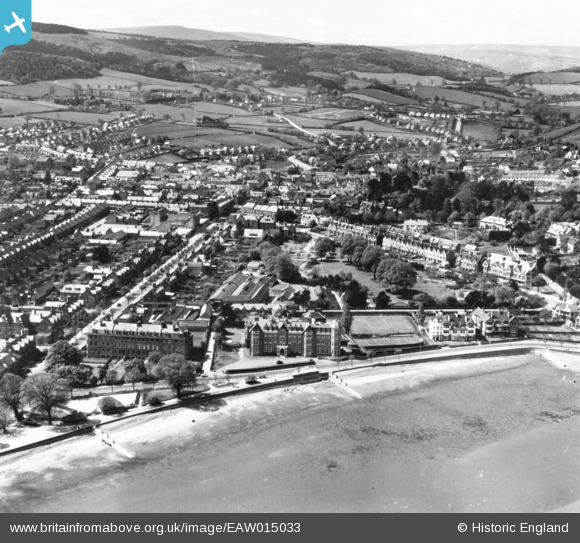
EAW015033 ENGLAND (1948). The town, Minehead, from the north-east, 1948. This image has been produced from a print.
© Copyright OpenStreetMap contributors and licensed by the OpenStreetMap Foundation. 2026. Cartography is licensed as CC BY-SA.
Nearby Images (7)
EAW015033

EPW033287

EPW033288

EPW033298

EAW015031

EPW039961

EPW033299

Details
| Title | [EAW015033] The town, Minehead, from the north-east, 1948. This image has been produced from a print. |
| Reference | EAW015033 |
| Date | 27-April-1948 |
| Link | |
| Place name | MINEHEAD |
| Parish | MINEHEAD |
| District | |
| Country | ENGLAND |
| Easting / Northing | 297306, 146473 |
| Longitude / Latitude | -3.4702601434722, 51.207703954739 |
| National Grid Reference | SS973465 |
Pins

redmist |
Friday 10th of July 2020 05:15:13 PM | |
|
redmist |
Friday 10th of July 2020 05:12:49 PM | |
|
redmist |
Friday 10th of July 2020 05:12:30 PM | |
|
Toby Clempson |
Wednesday 3rd of September 2014 07:23:18 AM |