
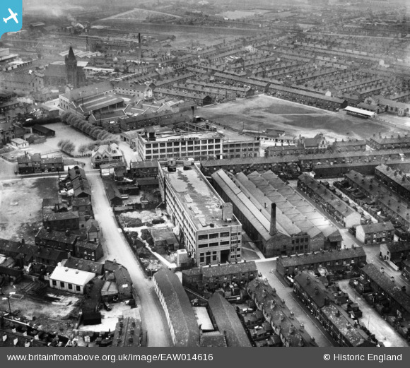
EAW014616 ENGLAND (1948). The Alliance Box Co Ltd Alliance Works and environs, Warrington, 1948
© Copyright OpenStreetMap contributors and licensed by the OpenStreetMap Foundation. 2026. Cartography is licensed as CC BY-SA.
Nearby Images (19)
EAW014616

EAW050349

EAW050348

EAW014618

EAW014619

EAW014612

EAW050347

EAW014615

EAW014617

EAW050345

EAW014613

EAW050352

EAW050351

EAW014614

EAW014621

EAW050346

EAW050350

EAW014622

EAW014620

Details
| Title | [EAW014616] The Alliance Box Co Ltd Alliance Works and environs, Warrington, 1948 |
| Reference | EAW014616 |
| Date | 21-April-1948 |
| Link | |
| Place name | WARRINGTON |
| Parish | |
| District | |
| Country | ENGLAND |
| Easting / Northing | 360778, 388918 |
| Longitude / Latitude | -2.5899024563411, 53.395372745947 |
| National Grid Reference | SJ608889 |
Pins

Paul1867 |
Friday 16th of April 2021 02:25:25 PM | |
|
Paul1867 |
Friday 16th of April 2021 02:24:22 PM | |
|
redmist |
Monday 20th of July 2020 04:46:46 PM | |
|
pillboxhunter |
Sunday 19th of January 2020 07:03:13 PM |