
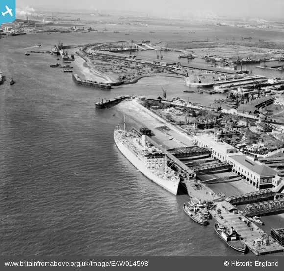
EAW014598 ENGLAND (1948). RMS Strathaird in dock, Tilbury, 1948
© Copyright OpenStreetMap contributors and licensed by the OpenStreetMap Foundation. 2026. Cartography is licensed as CC BY-SA.
Nearby Images (17)
EAW014598

EAW014599

EAW014600

EAW028721

EPW032065
 railway station and environs, Tilbury, 1930")
EPW044226

EPW044224

EPW024911

EAW014601

EPW032063
 railway station and environs, Tilbury, 1930")
EPW044227

EPW032062
 railway station and environs, Tilbury, from the south, 1930")
EPW044219

EPW032061
 railway station and environs, Tilbury, 1930")
EPW044216

EAW034857

EPW032060
 railway station and environs, Tilbury, 1930")
Details
| Title | [EAW014598] RMS Strathaird in dock, Tilbury, 1948 |
| Reference | EAW014598 |
| Date | 16-April-1948 |
| Link | |
| Place name | TILBURY |
| Parish | |
| District | |
| Country | ENGLAND |
| Easting / Northing | 564230, 175069 |
| Longitude / Latitude | 0.36379674527554, 51.450265612439 |
| National Grid Reference | TQ642751 |
Pins

Blifster |
Tuesday 8th of June 2021 08:00:35 PM | |
|
stack1378 |
Wednesday 2nd of January 2019 12:55:04 AM | |
|
mannidaze |
Monday 10th of November 2014 05:07:13 PM | |
|
totoro |
Friday 17th of January 2014 07:10:10 PM | |
|
totoro |
Friday 17th of January 2014 07:06:40 PM | |
|
totoro |
Friday 17th of January 2014 06:59:42 PM | |
|
totoro |
Friday 17th of January 2014 06:57:36 PM | |
|
totoro |
Friday 17th of January 2014 06:45:29 PM |
User Comment Contributions
Not to be pedantic, the dock is shown in the background. The ship Strathaird is in fact on the Landing Stage, on the Thames. |
Mark Nunnery |
Sunday 19th of January 2014 02:55:23 PM |
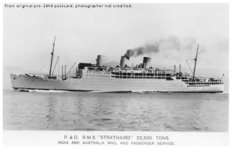
Ship with three funnels prior to 1948 from a post card |
totoro |
Friday 17th of January 2014 06:42:10 PM |