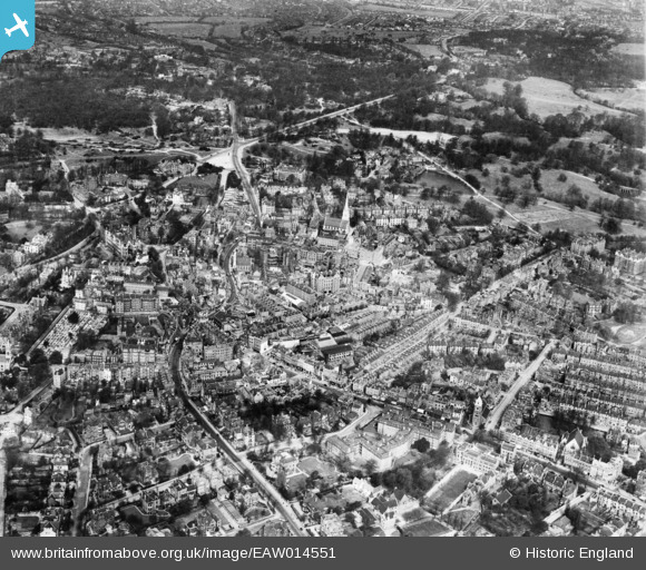
EAW014551 ENGLAND (1948). The Vale of Health, Hampstead, 1948
    © Copyright OpenStreetMap contributors and licensed by the OpenStreetMap Foundation. 2025. Cartography is licensed as CC BY-SA.
  
Nearby Images (15)
Details
| Title | [EAW014551] The Vale of Health, Hampstead, 1948 | 
| Reference | EAW014551 | 
| Date | 15-May-1948 | 
| Link | |
| Place name | HAMPSTEAD | 
| Parish | |
| District | |
| Country | ENGLAND | 
| Easting / Northing | 526467, 185968 | 
| Longitude / Latitude | -0.1754851716829, 51.557921605076 | 
| National Grid Reference | TQ265860 | 
Pins
Be the first to add a comment to this image!
 
             
  ![[EAW014551] The Vale of Health, Hampstead, 1948](http://britainfromabove.org.uk/sites/all/libraries/aerofilms-images/public/100x100/EAW/014/EAW014551.jpg) 
  
                                          ![[EAW000611] Christ Church, Heath Street and Hampstead Heath, Hampstead, 1946](http://britainfromabove.org.uk/sites/all/libraries/aerofilms-images/public/100x100/EAW/000/EAW000611.jpg) 
 ![[EAW000625] Christ Church, Heath Street and West Heath, Hampstead, 1946](http://britainfromabove.org.uk/sites/all/libraries/aerofilms-images/public/100x100/EAW/000/EAW000625.jpg) 
 ![[EAW000613] Christ Church and West Heath, Hampstead, from the south-east, 1946](http://britainfromabove.org.uk/sites/all/libraries/aerofilms-images/public/100x100/EAW/000/EAW000613.jpg) 
 ![[EPW056651] The High Street and environs, Hampstead, 1938. This image was marked by Aerofilms Ltd for photo editing.](http://britainfromabove.org.uk/sites/all/libraries/aerofilms-images/public/100x100/EPW/056/EPW056651.jpg) 
 ![[EPW056830] Heath Street, Holly Hill and environs, Hampstead, 1938](http://britainfromabove.org.uk/sites/all/libraries/aerofilms-images/public/100x100/EPW/056/EPW056830.jpg) 
 ![[EAW014553] The Vale of Health, Hampstead, 1948. This image has been produced from a damaged negative.](http://britainfromabove.org.uk/sites/all/libraries/aerofilms-images/public/100x100/EAW/014/EAW014553.jpg) 
 ![[EPW056831] Mount Vernon and environs, Hampstead, 1938](http://britainfromabove.org.uk/sites/all/libraries/aerofilms-images/public/100x100/EPW/056/EPW056831.jpg) 
 ![[EPW056656] Whitestone Pond and environs, Hampstead Heath, 1938](http://britainfromabove.org.uk/sites/all/libraries/aerofilms-images/public/100x100/EPW/056/EPW056656.jpg) 
 ![[EPW057007] University College School and environs, Hampstead, 1938](http://britainfromabove.org.uk/sites/all/libraries/aerofilms-images/public/100x100/EPW/057/EPW057007.jpg) 
 ![[EPW056833] The High Street and environs, Hampstead, from the east, 1938](http://britainfromabove.org.uk/sites/all/libraries/aerofilms-images/public/100x100/EPW/056/EPW056833.jpg) 
 ![[EAW000610] Christ Church, Heath Street and East Heath, Hampstead, 1946](http://britainfromabove.org.uk/sites/all/libraries/aerofilms-images/public/100x100/EAW/000/EAW000610.jpg) 
 ![[EAW000614] Heath Street, Holly Hill and West Heath, Hampstead, 1946](http://britainfromabove.org.uk/sites/all/libraries/aerofilms-images/public/100x100/EAW/000/EAW000614.jpg) 
 ![[EPW057006] University College School and environs, Hampstead, 1938](http://britainfromabove.org.uk/sites/all/libraries/aerofilms-images/public/100x100/EPW/057/EPW057006.jpg) 
 ![[EPW011417] View of Hampstead and the Heath, Hampstead, 1924](http://britainfromabove.org.uk/sites/all/libraries/aerofilms-images/public/100x100/EPW/011/EPW011417.jpg)