
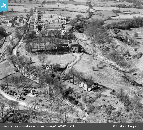
EAW014541 ENGLAND (1948). The remains of Morpeth Castle, Morpeth, 1948
© Copyright OpenStreetMap contributors and licensed by the OpenStreetMap Foundation. 2026. Cartography is licensed as CC BY-SA.
Nearby Images (4)
EAW014541

EAW014540

EAW014539

EAW014538

Details
| Title | [EAW014541] The remains of Morpeth Castle, Morpeth, 1948 |
| Reference | EAW014541 |
| Date | 15-April-1948 |
| Link | |
| Place name | MORPETH |
| Parish | MORPETH |
| District | |
| Country | ENGLAND |
| Easting / Northing | 420055, 585529 |
| Longitude / Latitude | -1.6851731558865, 55.163620557214 |
| National Grid Reference | NZ201855 |
Pins
Be the first to add a comment to this image!