
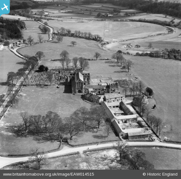
EAW014515 ENGLAND (1948). Lanercost Priory and Abbey Farm, Lanercost, 1948
© Copyright OpenStreetMap contributors and licensed by the OpenStreetMap Foundation. 2026. Cartography is licensed as CC BY-SA.
Nearby Images (2)
EAW014515

EAW014514

Details
| Title | [EAW014515] Lanercost Priory and Abbey Farm, Lanercost, 1948 |
| Reference | EAW014515 |
| Date | 14-April-1948 |
| Link | |
| Place name | LANERCOST |
| Parish | BURTHOLME |
| District | |
| Country | ENGLAND |
| Easting / Northing | 355607, 563707 |
| Longitude / Latitude | -2.6934672909568, 54.965933016798 |
| National Grid Reference | NY556637 |
Pins
Be the first to add a comment to this image!