
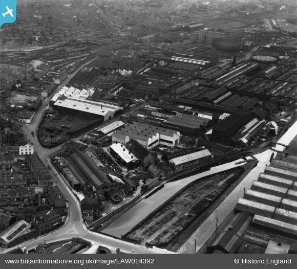
EAW014392 ENGLAND (1948). The Incandescent Heat Company Works on Cornwall Road and adjacent factories, Smethwick, 1948. This image has been produced from a print.
© Copyright OpenStreetMap contributors and licensed by the OpenStreetMap Foundation. 2026. Cartography is licensed as CC BY-SA.
Nearby Images (31)
EAW014392

EAW014395

EAW001562

EAW014397

EAW001560

EAW014396

EAW014398

EAW014391

EPW057433

EAW001559

EPW057435

EAW001561

EPW057439

EAW014394

EPW057438

EAW014393

EPW057434

EAW001558

EAW014399

EAW001563

EPW057436

EAW014390

EPW053093

EPW057437

EPW044406

EAW001556

EAW001557

EPW044407

EPW044408

EPW044411

EPW044409

Details
| Title | [EAW014392] The Incandescent Heat Company Works on Cornwall Road and adjacent factories, Smethwick, 1948. This image has been produced from a print. |
| Reference | EAW014392 |
| Date | 13-April-1948 |
| Link | |
| Place name | SMETHWICK |
| Parish | |
| District | |
| Country | ENGLAND |
| Easting / Northing | 402906, 289123 |
| Longitude / Latitude | -1.95718732771, 52.499635488022 |
| National Grid Reference | SP029891 |
Pins

Matt Aldred edob.mattaldred.com |
Friday 14th of May 2021 05:42:20 PM | |
|
Matt Aldred edob.mattaldred.com |
Friday 14th of May 2021 05:41:53 PM | |
 |

Class31 |
Friday 28th of August 2015 08:34:50 AM |
 |
Class31 |
Friday 28th of August 2015 08:33:53 AM |