
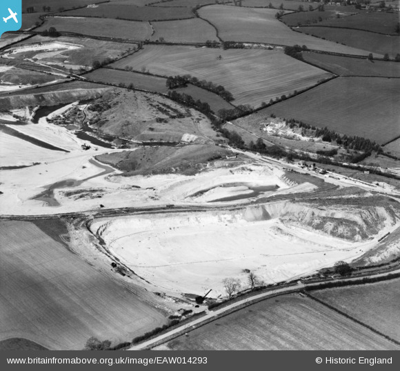
EAW014293 ENGLAND (1948). Chalk excavations to the east of the village, Heath and Reach, 1948
© Copyright OpenStreetMap contributors and licensed by the OpenStreetMap Foundation. 2026. Cartography is licensed as CC BY-SA.
Nearby Images (2)
EAW014293

EAW014289

Details
| Title | [EAW014293] Chalk excavations to the east of the village, Heath and Reach, 1948 |
| Reference | EAW014293 |
| Date | 12-April-1948 |
| Link | |
| Place name | HEATH AND REACH |
| Parish | HEATH AND REACH |
| District | |
| Country | ENGLAND |
| Easting / Northing | 494069, 228718 |
| Longitude / Latitude | -0.63114691824599, 51.948560971279 |
| National Grid Reference | SP941287 |
Pins

Martin |
Monday 20th of January 2014 05:51:18 PM | |
|
Martin |
Monday 20th of January 2014 05:51:17 PM | |
|
Joe90 |
Saturday 11th of January 2014 05:46:28 PM | |
|
Joe90 |
Saturday 11th of January 2014 05:43:34 PM | |
|
MB |
Tuesday 24th of December 2013 06:32:15 PM |
User Comment Contributions
This is not chalk!! It's Lower Greensand. |

Dylan Moore |
Wednesday 3rd of December 2014 12:17:41 PM |
Thank you Dylan. I had come to that conclusion about a nano second ago and then I read your comment. |

Class31 |
Wednesday 3rd of December 2014 12:17:41 PM |