
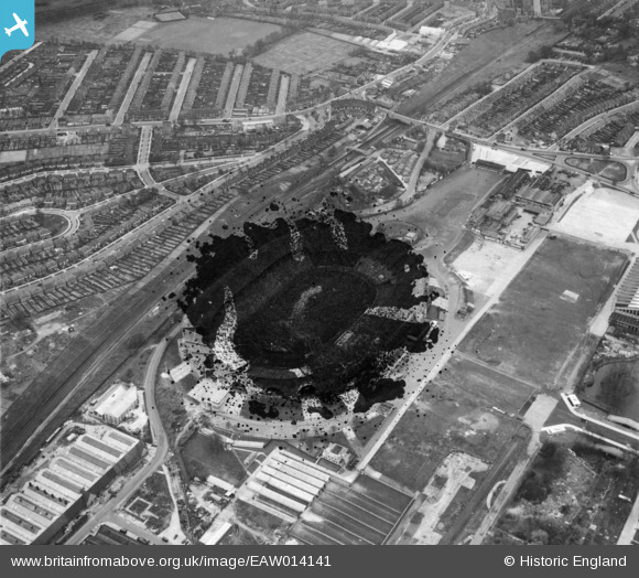
EAW014141 ENGLAND (1948). The Empire (Wembley) Stadium, Wembley Park, 1948. This image has been produced from a damaged negative.
© Copyright OpenStreetMap contributors and licensed by the OpenStreetMap Foundation. 2026. Cartography is licensed as CC BY-SA.
Nearby Images (48)
EAW014141
 Stadium, Wembley Park, 1948. This image has been produced from a damaged negative.")
EPW010458

EPW010461

EAW018312

EAW018311

EPW046913

EPW010456

EPW010462

EPW009655

EPW026438

EPW034581

EPW011412

EPW026433

EPW020862

EPW010457

EPW010460

EPW017636

EPW026431

EPW010459

EAW048878

EAW018313

EPW046905

EPW020341

EPW046907

EPW017635

EPW026434

EAW048879

EPW009652

EAW017617

EAW038566
 at Wembley Stadium, 1951. This image has been produced from a print.")
EPW046910

EAW038567
 at Wembley Stadium, 1951. This image has been produced from a print.")
EAW017618

EPW008076
 under construction, Wembley Park, from the north-west, 1922. This image has been produced from a copy-negative.")
EAW017619

EPW017623

EPW035048

EPW046914

EPW017625

EPW017624

EAW017620

EPW046906

EPW006967

EPW046239

EAW026796

EPW035047

EPW046238

EPR000222

Details
| Title | [EAW014141] The Empire (Wembley) Stadium, Wembley Park, 1948. This image has been produced from a damaged negative. |
| Reference | EAW014141 |
| Date | 7-April-1948 |
| Link | |
| Place name | WEMBLEY PARK |
| Parish | |
| District | |
| Country | ENGLAND |
| Easting / Northing | 519305, 185450 |
| Longitude / Latitude | -0.27893405963472, 51.554826251354 |
| National Grid Reference | TQ193855 |


