
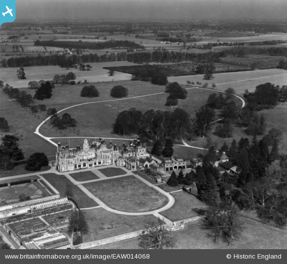
EAW014068 ENGLAND (1948). Flixton Hall and Park, Flixton, from the south, 1948. This image has been produced from a print.
© Copyright OpenStreetMap contributors and licensed by the OpenStreetMap Foundation. 2026. Cartography is licensed as CC BY-SA.
Nearby Images (2)
EAW014068

EAW014067

Details
| Title | [EAW014068] Flixton Hall and Park, Flixton, from the south, 1948. This image has been produced from a print. |
| Reference | EAW014068 |
| Date | 25-March-1948 |
| Link | |
| Place name | FLIXTON |
| Parish | FLIXTON |
| District | |
| Country | ENGLAND |
| Easting / Northing | 630429, 285813 |
| Longitude / Latitude | 1.3892826973375, 52.421294559578 |
| National Grid Reference | TM304858 |
Pins

Matt Aldred edob.mattaldred.com |
Sunday 16th of May 2021 10:15:48 PM | |

Ex_Aerofilms_Librarian |
Saturday 17th of March 2018 09:35:21 PM | |
|
Ex_Aerofilms_Librarian |
Saturday 17th of March 2018 09:34:29 PM |