
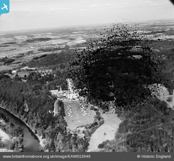
EAW013946 ENGLAND (1948). Cliveden House and Gardens, Cliveden, from the south, 1948. This image has been produced from a damaged negative.
© Copyright OpenStreetMap contributors and licensed by the OpenStreetMap Foundation. 2026. Cartography is licensed as CC BY-SA.
Nearby Images (11)
EAW013946

EAW013945

EPW005699

EAW013944

EPW012125

EAW042177

EAW013947

EPW005698

EPW056584

EAW042176

EPW012126

Details
| Title | [EAW013946] Cliveden House and Gardens, Cliveden, from the south, 1948. This image has been produced from a damaged negative. |
| Reference | EAW013946 |
| Date | 22-March-1948 |
| Link | |
| Place name | CLIVEDEN |
| Parish | TAPLOW |
| District | |
| Country | ENGLAND |
| Easting / Northing | 491045, 184968 |
| Longitude / Latitude | -0.68659784160931, 51.555763382966 |
| National Grid Reference | SU910850 |
Pins
Be the first to add a comment to this image!