
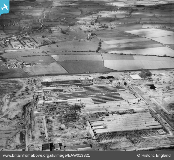
EAW013821 ENGLAND (1948). Construction of Paton and Baldwins Worsted Spinning Mill at Lingfield Point, Lingfield, 1948
© Copyright OpenStreetMap contributors and licensed by the OpenStreetMap Foundation. 2026. Cartography is licensed as CC BY-SA.
Nearby Images (41)
EAW013821

EAW022807

EAW013816

EAW013820

EAW027446

EAW013824

EAW007638

EAW027453

EAW007633

EAW017434

EAW007623

EAW023499

EAW027443

EAW034283

EAW007640

EAW007628

EAW007639

EAW027449

EAW027455

EAW017439

EAW013814

EAW013823

EAW023498

EAW017428

EAW013817

EAW022801

EAW023500

EAW027445

EAW007629

EAW013819

EAW023501

EAW013822

EAW023504

EAW027451

EAW022813

EAW023503

EAW027441

EAW022800

EAW027456

EAW007634

EAW027448

Details
| Title | [EAW013821] Construction of Paton and Baldwins Worsted Spinning Mill at Lingfield Point, Lingfield, 1948 |
| Reference | EAW013821 |
| Date | 16-March-1948 |
| Link | |
| Place name | LINGFIELD |
| Parish | |
| District | |
| Country | ENGLAND |
| Easting / Northing | 431587, 515277 |
| Longitude / Latitude | -1.5118303537293, 54.531656020663 |
| National Grid Reference | NZ316153 |
Pins
Be the first to add a comment to this image!