
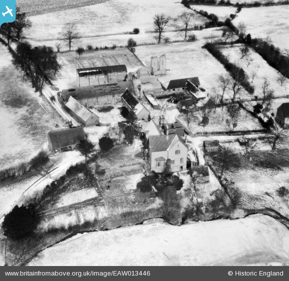
EAW013446 ENGLAND (1948). St Mary's Abbey ruins and Manor Abbey Farm, Halesowen, 1948
© Copyright OpenStreetMap contributors and licensed by the OpenStreetMap Foundation. 2025. Cartography is licensed as CC BY-SA.
Nearby Images (3)
EAW013446

EAW013447

EAW013445

Details
| Title | [EAW013446] St Mary's Abbey ruins and Manor Abbey Farm, Halesowen, 1948 |
| Reference | EAW013446 |
| Date | 20-February-1948 |
| Link | |
| Place name | HALESOWEN |
| Parish | |
| District | |
| Country | ENGLAND |
| Easting / Northing | 397591, 282798 |
| Longitude / Latitude | -2.0354449008894, 52.442769713263 |
| National Grid Reference | SO976828 |
Pins
Be the first to add a comment to this image!