
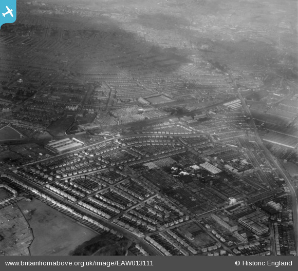
EAW013111 ENGLAND (1948). The Rolls Royce Nightingale Road Works and surrounding residential districts, Osmaston, from the south-east, 1948
© Copyright OpenStreetMap contributors and licensed by the OpenStreetMap Foundation. 2026. Cartography is licensed as CC BY-SA.
Nearby Images (9)
EAW013111

EAW013117

EPW046673

EAW013113

EPW046677

EAW013119

EPW046678

EAW013109

EAW013116

Details
| Title | [EAW013111] The Rolls Royce Nightingale Road Works and surrounding residential districts, Osmaston, from the south-east, 1948 |
| Reference | EAW013111 |
| Date | 4-February-1948 |
| Link | |
| Place name | OSMASTON |
| Parish | |
| District | |
| Country | ENGLAND |
| Easting / Northing | 436158, 333453 |
| Longitude / Latitude | -1.4624405088188, 52.896983593549 |
| National Grid Reference | SK362335 |
Pins

Triggy |
Wednesday 3rd of February 2016 10:41:11 PM | |
|
Triggy |
Wednesday 3rd of February 2016 10:38:04 PM | |
|
Triggy |
Wednesday 3rd of February 2016 10:36:57 PM | |
|
Triggy |
Wednesday 3rd of February 2016 10:35:58 PM | |
|
gBr |
Tuesday 10th of November 2015 08:29:34 PM | |
Not the greyhound stadium, this is nearer the cricket ground. |
Triggy |
Wednesday 3rd of February 2016 10:42:40 PM |
|
Triggy |
Sunday 9th of February 2014 08:50:18 PM | |
|
Al |
Friday 6th of December 2013 08:31:42 PM | |
|
Al |
Friday 6th of December 2013 08:31:19 PM |