
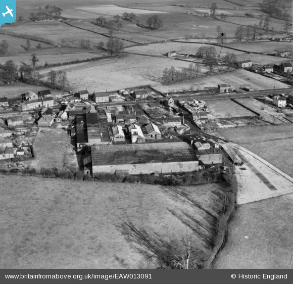
EAW013091 ENGLAND (1948). The Mendip Engineering Works, Atworth, 1948
© Copyright OpenStreetMap contributors and licensed by the OpenStreetMap Foundation. 2026. Cartography is licensed as CC BY-SA.
Nearby Images (19)
EAW013091

EAW013089

EAW013093

EAW013016

EAW013088

EAW013015

EAW013094

EAW013011

EAW013018

EAW013013

EAW013012

EAW013014

EAW013010

EAW013096

EAW013097

EAW013092

EAW013090

EAW013017

EAW013095

Details
| Title | [EAW013091] The Mendip Engineering Works, Atworth, 1948 |
| Reference | EAW013091 |
| Date | 21-January-1948 |
| Link | |
| Place name | ATWORTH |
| Parish | ATWORTH |
| District | |
| Country | ENGLAND |
| Easting / Northing | 386849, 165838 |
| Longitude / Latitude | -2.1890283144893, 51.390933679677 |
| National Grid Reference | ST868658 |
