
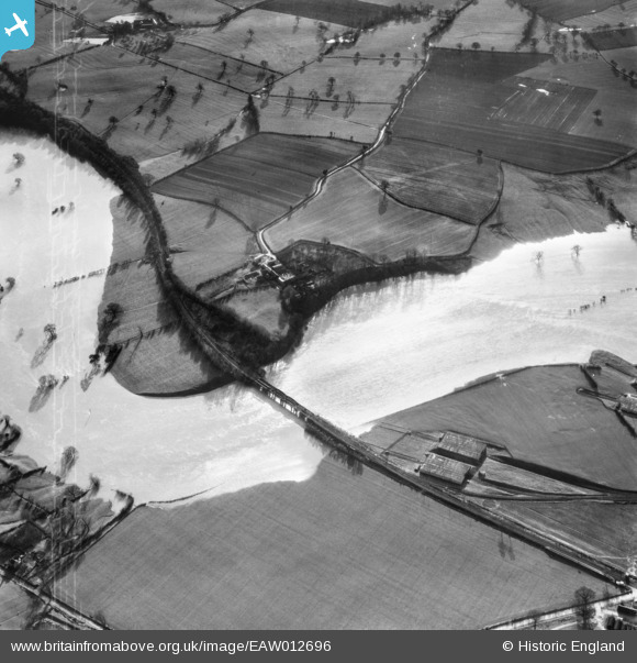
EAW012696 ENGLAND (1948). Railway bridge over a flooded River Severn near Little Shrawardine Farm, Little Shrawardine, 1948
© Copyright OpenStreetMap contributors and licensed by the OpenStreetMap Foundation. 2026. Cartography is licensed as CC BY-SA.
Nearby Images (3)
EAW012696

EAW012695

EAW012694

Details
| Title | [EAW012696] Railway bridge over a flooded River Severn near Little Shrawardine Farm, Little Shrawardine, 1948 |
| Reference | EAW012696 |
| Date | 14-January-1948 |
| Link | |
| Place name | LITTLE SHRAWARDINE |
| Parish | ALBERBURY WITH CARDESTON |
| District | |
| Country | ENGLAND |
| Easting / Northing | 339258, 315219 |
| Longitude / Latitude | -2.8996187106531, 52.730855167096 |
| National Grid Reference | SJ393152 |
Pins

Al |
Saturday 31st of January 2015 08:49:50 PM | |
|
Al |
Saturday 31st of January 2015 08:49:19 PM | |
|
Al |
Saturday 31st of January 2015 08:48:13 PM |
User Comment Contributions

elements of Nesscliffe Ordnance depot at Shrawardine on the line of the requisitioned Shropshire and Montgomeryshire Railway see http://www.hfstephens-museum.org.uk/smlr/the-smr-in-world-war-ii |
Al |
Saturday 31st of January 2015 08:51:23 PM |