
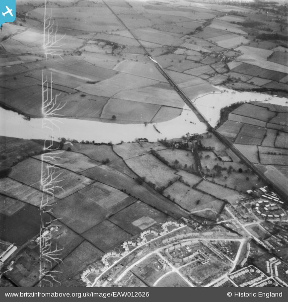
EAW012626 ENGLAND (1948). The River Severn in flood at Monkmoor, Shrewsbury, 1948. This image has been produced from a damaged negative.
© Copyright OpenStreetMap contributors and licensed by the OpenStreetMap Foundation. 2026. Cartography is licensed as CC BY-SA.
Nearby Images (2)
EAW012626

EAW012529

Details
| Title | [EAW012626] The River Severn in flood at Monkmoor, Shrewsbury, 1948. This image has been produced from a damaged negative. |
| Reference | EAW012626 |
| Date | 14-January-1948 |
| Link | |
| Place name | SHREWSBURY |
| Parish | SHREWSBURY |
| District | |
| Country | ENGLAND |
| Easting / Northing | 351821, 312906 |
| Longitude / Latitude | -2.7132329962534, 52.71132677849 |
| National Grid Reference | SJ518129 |
Pins
Be the first to add a comment to this image!